
El Niño, what is it? How will it impact Harford County’s winter in 2026-2027
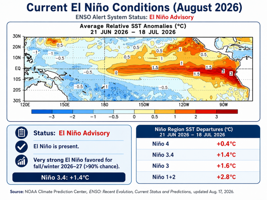
Lately, TV news has featured stories about a weather phenomenon called El Niño and how it will impact the United States this winter. Specifically, many scientists predict a larger-than-normal El Niño that will affect the weather in the United States. For
arford County, this could mean a wetter and possibly a snowier winter. Before we talk about what this means for Harford County, it helps to understand what an El Niño is. How does it fit into the larger ENSO (El Niño Southern Oscillation) cycle? Then we can talk about the impact on the United States and Harford County, Maryland.
An El Niño is the warm phase of the El Niño Southern Oscillation Cycle. The ENSO cycle also has a cool phase called La Niña. The ENSO cycle is a climate phenomenon that originates over the tropical Pacific Ocean. Each phase can last several months or more and can affect weather worldwide. What starts an El Niño is a combination of the trade winds in the Pacific that blow from the east to the west slowing down or even reversing and some of that warmer water evaporating into the atmosphere. So, the warm surface water that normally gets pushed to the Asian continent stays to the east, and the cooler upwelling water that happens in South America when this warm surface water is pushed to Asia gets disrupted. With the warmer surface water remaining farther east across the central and eastern tropical Pacific, more heat and moisture are transferred into the atmosphere. This changes where thunderstorms and rising air occur over the tropical Pacific. Those changes disrupt atmospheric circulation patterns and, in turn, affect the jet stream. During a typical El Niño winter, the Pacific jet stream becomes stronger and extends farther east across the southern United States. This tends to steer more storms across the southern part of the country, making the southern United States more likely to experience wetter-than-normal conditions. Meanwhile, the northern United States often experiences milder and drier conditions.
The question is: how does this affect the weather in Harford County, Maryland? During stronger El Niño winters, the more active subtropical jet can allow moisture-rich storm systems to travel northward into the Mid-Atlantic. Historically, strong El Niño winters in the Baltimore and Washington region have tended to be wetter than normal. However, increased moisture does not necessarily mean increased snowfall. If sufficiently cold air is in place when one of these storms reaches Maryland, Harford County could receive significant snow. If the air is too warm, that same moisture may simply fall as rain.
| Winter | El Niño character | Baltimore-area result |
| 1957–58 | Strong | Major snowy winter; Baltimore had a 14.4-inch storm in February 1958 |
| 1972–73 | Strong | Only 1.2 inches for the entire Baltimore snow season |
| 1982–83 | Strong | Very snowy; Baltimore received 22.8 inches in one storm Feb. 11, 1983 |
| 1997–98 | Very strong | Extremely wet but extraordinarily snow-poor; Washington had just 0.1″, and Baltimore was also exceptionally low |
| 2015–16 | Very strong | Baltimore received 29.2 inches in the Jan. 22–23 blizzard alone, its largest 2-day snowfall on record |
https://www.weather.gov/lwx/winter_storm-pr?utm_source=chatgpt.com
In conclusion, if you are wondering whether we will get more snow than normal in Harford County, the answer is that it depends on factors that can’t be predicted until late fall and winter. Even then, given the physics and complexities of any given storm, you just don’t know. As for me, I already have my 40 pounds of ice melt, a new snow shovel, and two tools to break ice!
-Bradley